RTMapperMobile
This software currently support Android platform. You can use this software to capture photo or video by defined area or waypoints.
User interface
This APP has following GUI components:
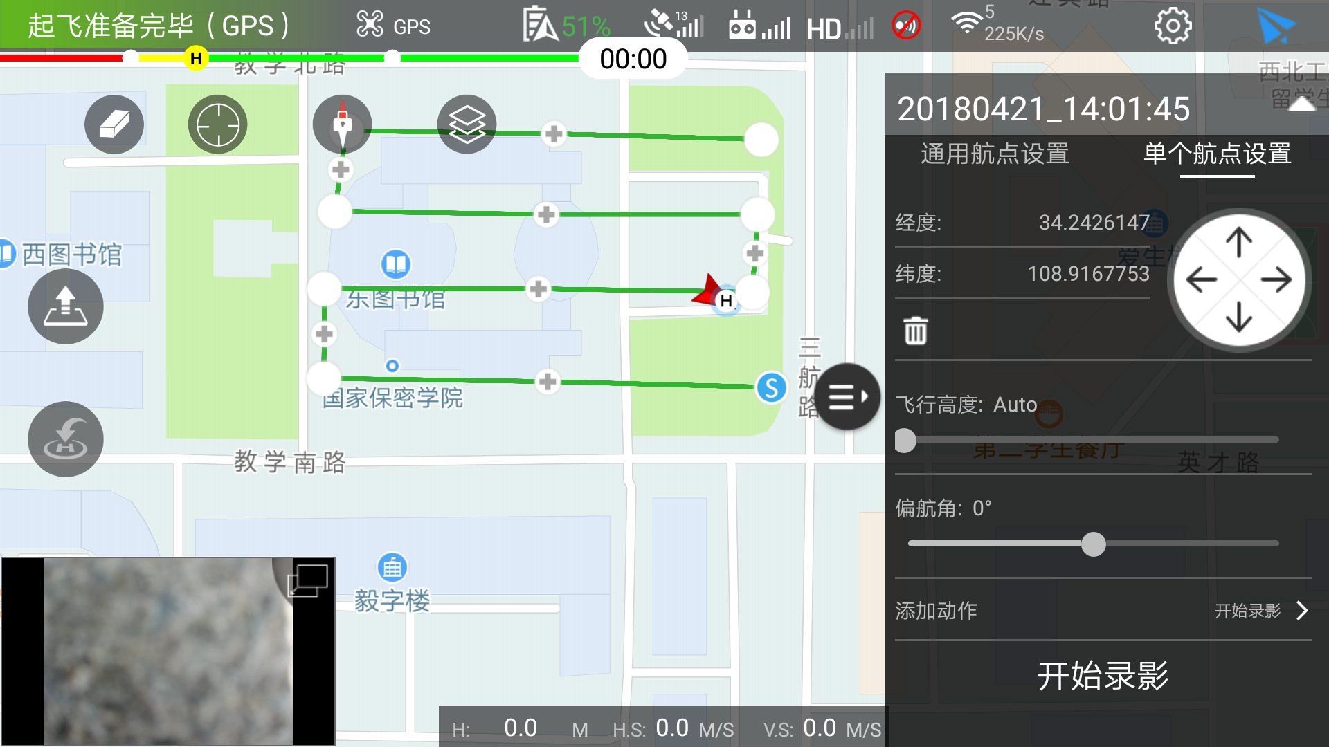
- UAV status pannel (on top-left): Display and control UAV settings.
- Setup and Flight button (on top-right): Setup the system parameters or start/stop mission.
- Mission pannel (right): Add/Edit/Delete mission, and setting mission parameters.
- Video viewport (bottom-left): Showing received vide stream.
Missions
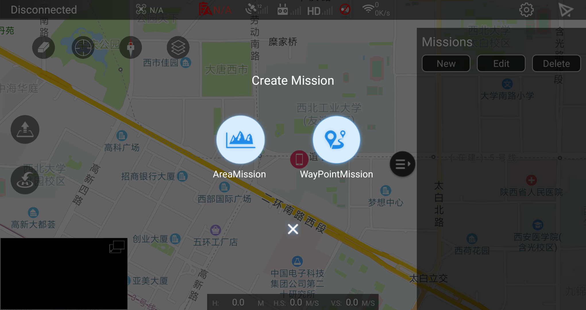
This APP will greatly reduce the workload for capture given area's images. Currently, there are two types of mission supported:
- Area mission: You can draw a region, and the waypoints will be automatically generated to cover the region.
- Waypoints mission: You can draw waypoints in the map, the UAV will follow the waypoint to take photos or video.
Mission parameters
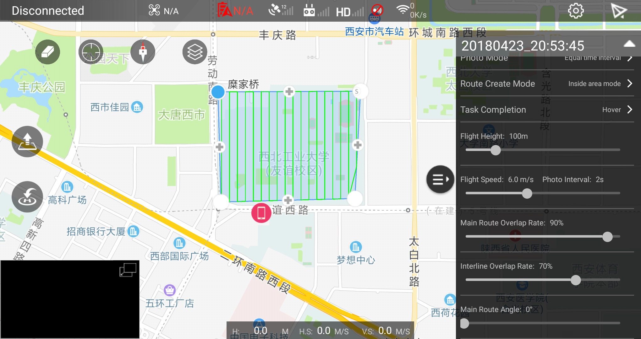
Camera Model: The camera currently mounted. To match your UAV model.Camera Orientation: The pitch angle of cameraPhoto Mode: The photo capture modeEqual time intervalcapture images in same time intervalIsometric intervalcaputure images in same distance intervalNo photodo not take photo, please use this mode for real-time map creationFlight Height: Control the UAV height for recording videoFlight Speed: Control the horizontal flight speedInterline Overlap Rate: Control the width's overlap ratioMain Route Angle: Generated route's angle to North-Sourths

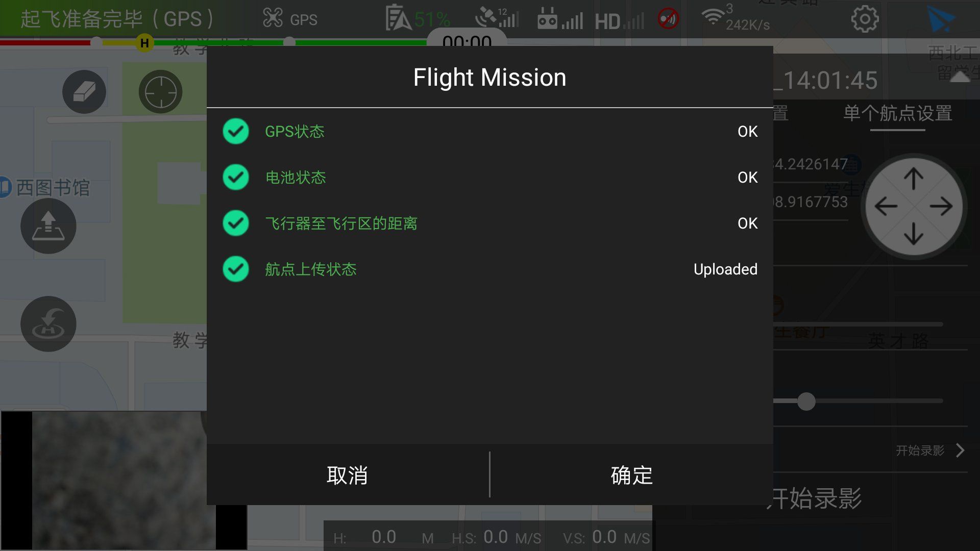
Start mission
When you mission has been setted and checked. You can click paper-plane icon (top-right of screen) to start the mission. It is very important to confirm the UAV's status and mission data are correct before start the mission.